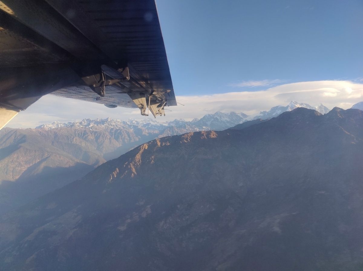
The great peaks and valleys of the Himalayan range and the wide presence of the Nepali landscape attract adventure-seekers and travelers from across the world. But before actual treks and adventure activities begin, the skies are shared with aircraft that fly through airspace regarded as the world’s most difficult to navigate.
From the perspective of air traffic controllers (ATCs) looking out into Nepal’s airspace, we have the privilege of operating within these skies, but it’s also our responsibility, which requires us to be precise, resilient, and, most importantly, focused. These people represent the unseen heroes who guard the safe transit of all these planes, whether it’s an airline flight, an aircraft flying over the Himalayas, or one heading to some remote base camp.
Why is Nepal's airspace unique?
Nepal has extremely uneven and difficult geography. The Himalayas climb rapidly from the river basins, forming a complex network of ridges and valleys. Weather systems can change radically over short distances, with turbulence swirling crazily around mountain summits and updrafts developing erratically in narrow gorges. Though these high hills and mountains represent a heaven for tourists seeking adventure holidays, it also presents one of the most challenging aviation environments for pilots and air traffic controllers.
Mountain flight departures and arrivals, like those to and from Lukla, the "Gateway to Mount Everest," require careful planning and time management. Lukla airport's runway is positioned with its slope at a level that doesn’t permit any margin for error. It is at these airports where the role of the ATC is limited to issuing clearance; we become partners in the flight planning and operation process.
Communicating in a complex sky
The backbone of air traffic control is communication. Each pilot interaction, whether for a climb, a change in course, or weather, is part of a live mosaic of airspace awareness. In Nepal, communication is critical. Air traffic controllers listen not only for the expected acknowledgment calls, but for important signs such as change in aircraft performance, a mention of turbulence, a sudden shift in weather patterns. Along with this they provide various important information prior to taking off like:
- Route and altitude plans adapted to present weather conditions in mountains,
- Separation assurance for the avoidance of conflicts with other aircraft,
- Weather information that is derived through ground stations, pilots, and even satellite communications.
Once we get our planes in the air, they are continuously tracked. Should weather turn bad close to a pass, or if there is a reported sudden updraft close to a peak, we communicate this immediately. A few seconds’ warning is critical to mountain aviation.
Technology meets terrain
In areas with irregular obstacles (“terrain” in aviation), the availability of ground radar coverage has been impacted. We have managed the challenge using ground radar systems, radio communication, and more recently, satellite-based navigation systems (like ADS-B). These help track aircraft even when radar signals cannot reach due to terrain interference.
In bringing these traditional and modern technologies together, we are able to provide an even higher level of safety. However, it would be shortsighted to assume that it replaces the need for human interaction. It is crucial that we have controllers who are knowledgeable about the conditions in mountainous regions when it comes to aircraft performance.
Partnership with pilots
In the mountains of Nepal, pilots aren’t only pilots; they are specialists too. They know the wind that whips around Annapurna, the icing that forms around Ganesh Himal, and the rapid fogs that engulf Solukhumbu. The ATCs and pilots communicate like climbers on ropes, side by side, trusting each other’s expertise.
When the crew asks, "REQUEST VISUAL CLIMB THROUGH THE PASS," we understand it not only as a set of words but rather as a process of reviewing wind information, forecast, and traffic in order to determine whether it’s safe to climb that route or if it’s better to come up with an alternative.
Protecting adventure and lives
Adventure tourism has become one of the most critical sectors for Nepal’s economy. The scenic flight over Everest, heli tour, or stay at remote lodges means that people from remote communities get an economic lifeline when planes land or take off safely from those areas. Each flight that gets them back home or away means that not only do they get their lives, but they get their livelihood.
From the ATC perspective, the feeling of fulfillment is profound. When trekkers wave from the tarmac in Jomsom, or when the flight arrives in Kathmandu as the rain cloud breaks, we understand that our work has actually facilitated the realization of someone’s dreams.
The human spirit in the Himalayan skies
Flying around the Himalayas means experiencing a rush, and that’s not just for travelers but also for pilots and the air traffic controllers who direct them on their routes. It’s a delicate balance between man’s expertise and the power of nature. As air traffic controllers, our role is both remarkably straightforward and incredibly challenging; we are simply trying to protect each and every flight passing through the beautiful skies around the Himalayas.
"In this world where the earth seems to reach for the heavens, we stand guard to ensure that every climb and descent connects our people with adventure safely."
(Shrestha is a senior officer (ATC) at the Civil Aviation Authority of Nepal)