A few days ago, I had to go to Bhulakhya Dabu (a dabali or open stage) located in Madhyapur Thimi. Although my home is also in Thimi Municipality, I find it difficult to reach certain places through the narrow alleys.
I searched for the place on Google Maps. But it turned out Google doesn't provide much information on narrow alleys. Then I downloaded an app called Galli Maps. The map even had images with 360-degree views of the location. So I had no trouble finding the place.
Thanks to Galli Maps, I no longer fear getting lost in Kathmandu's alleys.
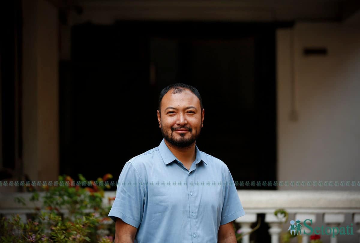
Credit for creating this map goes to Raj Bikram Maharjan of Kathmandu. Though an aeronautical engineer, it was his experiences rather than academics that inspired him to create this map.
Raj Bikram’s father worked as a technician at the airport. Seeing aeronautical engineers in high-ranking positions, his father wanted his son to work in a similar field. Raj Bikram followed his father’s dream and went to China in 2010 to pursue it.
After studying in China for four years, he returned to Nepal and began working at Himalaya Airlines in 2014. But shortly after he started working, the devastating 2015 earthquake hit Nepal. Flights were halted.
Just as people were beginning to return to normal life after the earthquake, India imposed a blockade on Nepal. Flights were again affected.
With no airline work, Raj Bikram had ample free time. In his university in China, he had learned how to build drones that could fly in the sky, known then as RC (remote-controlled) planes. He started building and flying them as a hobby.
After the earthquake, demand for such small planes suddenly increased. The term 'drone' also became widely accepted. Raj Bikram, who had knowledge of drones, became active in works outside of the airline. He traveled to different places outside the Kathmandu Valley during that time.
“I'm a guy from the Kathmandu Valley. The only place I had been outside was to China. After the earthquake, I visited many places like Nuwakot and Jhapa in the east,” he said. “Until then, I hadn’t really seen what a village looked like. I was amazed to see one.”
The earthquake had also damaged many heritage sites in the Kathmandu Valley. The famous Kasthamandap Temple — renowned to have been built from a single tree — had collapsed and was awaiting reconstruction. Technical and non-technical teams were formed to rebuild it, and Raj Bikram was part of that group.
“I was observing the temple construction closely. When the architects collected old photos and measured the temple, it made me wonder what they were doing. I was even more surprised to learn that the Department of Archaeology had no records of the temple,” he shared.
One day, a German team came to conduct photogrammetry on the Kasthamandap Temple. (Photogrammetry is the process of taking photographs and creating 3D models from them.) A German university trained its students on the site.
Raj Bikram was surprised again when he saw Nepali technicians still using rulers and pencils to take measurements of the temple while the Germans were doing it all with the help of photos.
He asked the German team, “Can we also learn from you?”
The team didn’t show much interest. So, Raj Bikram took the initiative himself. While working at the airline, he had created some 3D models. He wasn't sure if that would work for a temple, but he tried anyway.
He had drones. So he started capturing aerial images and created 3D models from them with the help of software. He was surprised with the results.
“The work that our technicians were doing with measuring tapes could apparently be done with the help of photos. By putting the photos into the software, we could easily calculate the length and width,” he said.”'That meant we neither had to climb up ladders, nor required ten architects. Just two people could take photos, and the measurements could easily be found out.”
This knowledge helped him work on Kasthamandap, Yatkha, Teku, and other temples. One day, he was given a project related to Keshar Mahal. The building was severely cracked, so it was hard to measure every corner.
Raj Bikram used a drone to easily do the measurements. For the first time, he took official approval for flying a drone. This was also the first time that he was paid for his work.
“At first, I didn’t even know approval was needed to fly drones. Approval was necessary also because Keshar Mahal is close to the Narayanhiti Palace. But I had to visit various government offices for almost three months to get the approval,” he said. "I was also astonished by the results from there."
As he honed his drone skills, Raj Bikram established a company called Airlift Nepal in 2017. The company initially proposed delivering medicine via drones to remote areas and even won a competition for its concept. Later, Raj Bikram took a two-month training under the 'South Asia Connect' program in India.
At that time, Raj Bikram was still working at the airline. After returning from the training, he quit the job and focused full-time on Airlift.
One of the major works that the company got was from the Lalitpur Metropolitan City. They were numbering houses using satellite maps and they asked Maharjan and his team to create 3D maps.
“We had only worked with 3D models before, but we agreed to try. It took three to four months to complete the map, but the results were excellent,” he said. “After the work was completed, I was stunned again. The map's quality was so high that you could clearly distinguish even a one- or two-rupee coin on a rooftop.”
After Lalitpur, they had only begun working in Kirtipur, Kageshwari, Kathmandu, and other places when the COVID-19 lockdown hit. Bored at home, Raj Bikram created a website called Bhugol Tour, which allowed people to explore heritage sites online.
It was around this time that he also got the idea for Galli Maps.
One day, Raj Bikram’s mother contracted COVID. No one from their household could go outside. So, he ordered an oximeter online for his mother. When the delivery person came, Raj Bikram tried to guide them using Google Maps, but the person couldn't find the house. They kept entering one alley after another without success.
“I had been bragging that the our map could show even one- or two-rupee coins on rooftops, yet I was having a hard time pointing my own house to the delivery person,” Raj Bikram said. “After Google Maps kept leading people to wrong places, I felt we needed our own map. I had used Baidu Maps while studying in China, and I thought, maybe we could do something similar in Nepal.”
The Lalitpur Metropolitan City had been numbering houses, but there was no system to locate them. They had thought of handing that responsibility to Google, but it wasn’t working out.
At that point, Raj Bikram suggested, “You should also create a system where people can find house numbers.”
Lalitpur said they lacked the expertise and asked Raj Bikram to do it. Having already built Bhugol Tour, Raj Bikram created Galli Maps with the help of two programmer friends.
While creating the map, they used street maps, government data, Google Maps, and their own verified records. Raj Bikram claims their map is a hundred times more accurate that that of Google.
“You can see Mangal Bazar’s alleys to individual houses in Asan — all with 360-degree views,” he said. “That way, when someone gives a house number, there’s no confusion whether it’s red or blue, four- or five-storied.”
A few days after launching Galli Maps, Raj Bikram received a call at 11 PM from someone in Bhaktapur who couldn’t find their alley on the map.
“A few days before that, a media outlet had interviewed me. They had apparently uploaded video clips of it on TikTok, which had gone viral,” he said.
Because of TikTok, the app was downloaded by more than 10,000 users in a single day. Another 10,000 downloads followed the next day.
“We weren’t prepared for that kind of sudden spike in users. It made us more responsible. Later, we even won an ICT award,” he said. “At the time, we were also working on software for other clients. After that, we completed all the other works and focused solely on Galli Maps.”
Currently, Galli Maps allows users to find houses in inner areas of Lalitpur, Kathmandu, Kageshwari, Kirtipur, and Banepa. It also helps locate restaurants, shops, ATMs, parking lots, hospitals, and more. It even shows events taking place in a certain place along with their time and venue.
“I always wanted to include Kathmandu’s festivals on the map. Last year, we tested it with Indra Jatra,” Raj Bikram said. “During Indra Jatra, someone is usually assigned just to track where Lakhe or Pulukisi has reached. Now we’ve integrated GPS tracking, and people can see the festival’s movement right on our map.”
Alongside Galli Maps, Raj Bikram’s Airlift company uses drones to solve real-world problems. After working on temples after the earthquake, the drones were used in agriculture, delivering medicine to remote areas, and even for showering flowers at events. Now, they’re used to deliver oxygen cylinders, ropes, ladders, and medicine to base camps — and to bring down garbage accumulated in the Himalayas.
“We have two drones that can carry up to 30 kilograms of goods. We lower a rope from a drone as big as a small helicopter via remote control, and Sherpas attach garbage and goods to it. We then transport the garbage and goods,” Raj Bikram said. “Last year, we did a 3D mapping project from Lukla to Everest Base Camp in Khumbu Pasang Lhamu Rural Municipality. After that, we began garbage collection and other work.”
So far, they’ve collected 500 kilograms of garbage from the Everest region and about 700 kilograms from Ama Dablam.
“This year, we plan to collect more than 1,000 kilograms of garbage from the Everest area,” Raj Bikram said. “We’re also working to improve Galli Maps. My wish is that those planning to visit Nepal come here after checking Galli Maps. I want to carry both of these ventures forward together.”